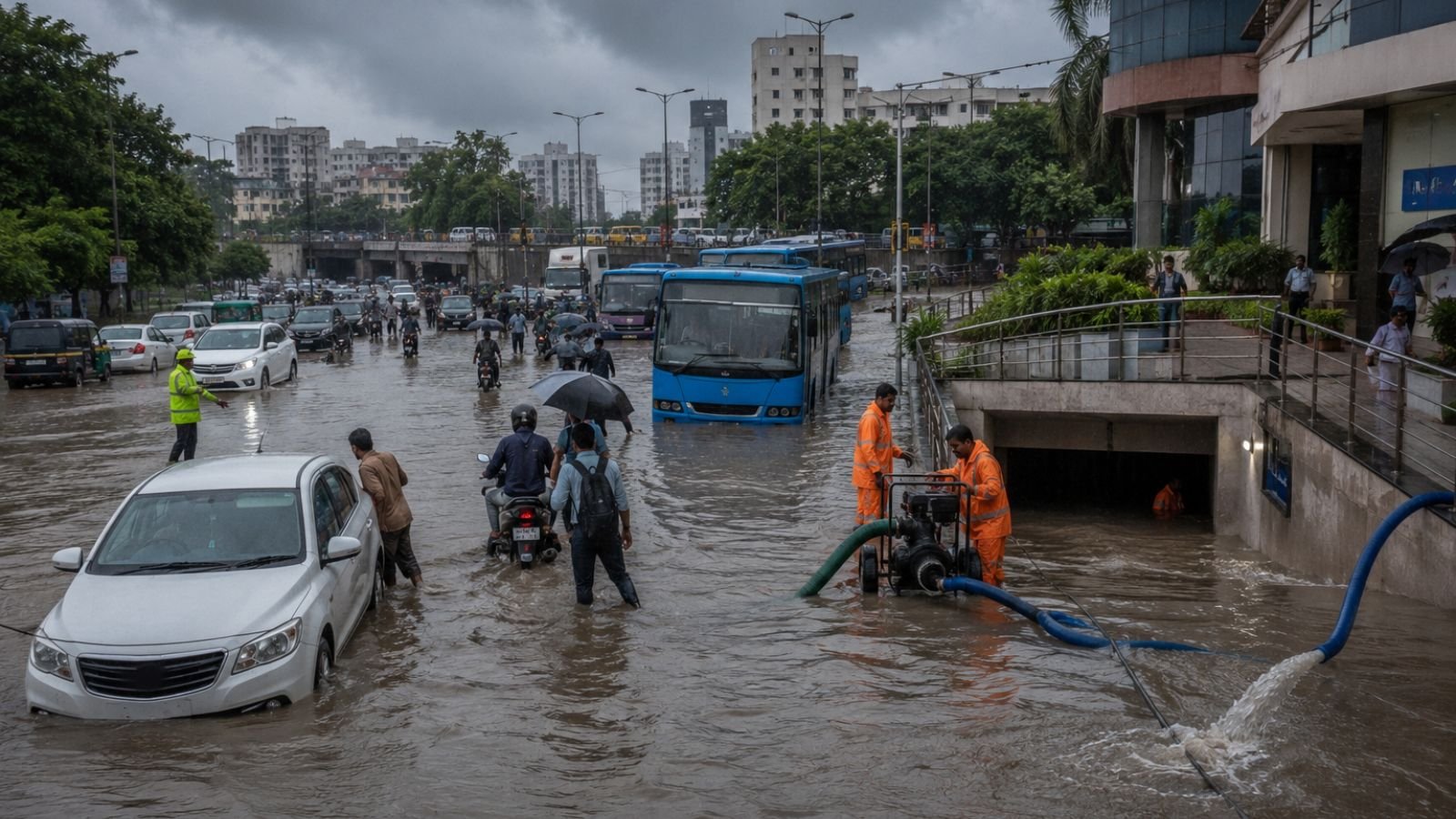
Surat is a city of resilience, known for its diamond polishing, textile trade and entrepreneurial spirit. Yet every monsoon, as the Tapi River swells and the Arabian Sea pushes high tides inland, a familiar crisis unfolds. Streets turn into rivers, homes are flooded and daily life comes to a standstill. For decades, Surat has grappled with chronic waterlogging, making it one of Gujarat’s most flood prone cities. The problem is not just about heavy rain. It is a complex interplay of geography, urban planning, and infrastructure that has failed to keep pace with the city rapid growth. Understanding why Surat floods year after year is the first step toward finding lasting solutions.
Why Waterlogging Becomes a Recurring Problem
The available information explains that Surat drainage system faces pressure whenever intense monsoon rainfall and high tides occur simultaneously. During such conditions, overflowing creeks reduce the capacity of stormwater drainage channels to discharge excess rainwater efficiently. As water remains trapped within the city drainage network, roads, underpasses, residential societies and commercial basements become flooded. This combination of natural geography and urban infrastructure has made seasonal waterlogging a recurring challenge across Surat.
Areas That Face the Most Severe Waterlogging
Several parts of Surat experience repeated flooding during heavy rainfall.
South and South West Zones
Low lying localities including Udhna, Vesu, Althan, Dindoli and Limbayat are among the worst affected areas. According to the available information, overflowing Mithi and Bhedwad creeks, combined with intense rainfall, frequently leave roads submerged under several feet of water, disrupting traffic and daily activities.
Katargam and Varachha
In the eastern and northern parts of the city, Katargam and Varachha also experience regular flooding. Areas such as Dabholi and locations near Kiran Hospital often become waterlogged during intense downpours, making important commuting routes temporarily inaccessible.
Commercial Areas and Underpasses
Several commercial corridors and underpasses remain particularly vulnerable. According to the available information, the Raghukul Railway Underpass, the Udhna Underpass, and stretches of VIP Road in Vesu repeatedly experience flooding, trapping vehicles and interrupting commercial activity during heavy rain.
Peripheral Areas
The city expanding outskirts are also affected. Localities including Saniya Hemad and Saroli often become temporarily isolated during severe rainfall, limiting road connectivity and making transportation difficult for residents.
How Waterlogging Affects the City
The available information highlights that prolonged waterlogging impacts multiple sectors simultaneously.
- Damage to commercial and textile businesses: Flooding inside commercial basements, particularly in Vesu and textile market areas, damages stored raw materials, electronic equipment and merchandise, resulting in significant financial losses for businesses
- Road damage and infrastructure erosion: Standing water gradually weakens road surfaces. As asphalt deteriorates, large potholes develop beneath stagnant water, increasing the risk of accidents and making road maintenance more difficult
- Increased risk for commuters: Flooded roads also create serious hazards for motorists and pedestrians. According to the available information, opening manhole covers to speed up drainage can create dangerous conditions for two wheeler riders and people travelling on foot
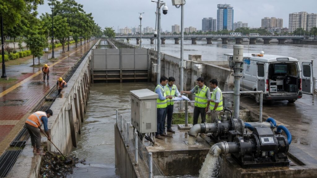
- Public health concerns: Water remaining inside residential societies for extended periods creates additional health challenges. Large scale pumping operations are often required to remove accumulated water and reduce the risk of vector borne diseases as well as contamination of local drinking water supplies
Engineering Measures Suggested for Long Term Flood Control
The available information outlines several structural measures that the Surat Municipal Corporation could adopt to improve the city flood resilience.
| Suggested Measure | Description |
|---|---|
| Strengthening Creek Management | Regular widening and desilting of major creeks including Mithi, Bhedwad and Kakrapar creeks before every monsoon. Installation of automated tidal floodgates at discharge points to prevent river water backflow |
| Expanding Stormwater Drainage | Redesigning existing drainage pipelines for higher rainfall intensity. Connecting newly developed areas with primary drainage network. Separating stormwater lines from domestic sewage |
| Permanent Dewatering Systems | Installing high capacity automated pumps at chronic waterlogging points like underpasses and commercial basements in Vesu |
| Rainwater Storage | Underground subsurface holding tanks beneath public parks to temporarily store excess stormwater and release it gradually |
| Smart Monitoring | SCADA based early warning system with automated water level sensors across 19 miles of internal creeks for real time overflow alerts |
| Better Urban Planning | Promoting permeable infrastructure like porous concrete on footpaths and parking areas to improve groundwater recharge and reduce surface runoff |
Smart Monitoring and Better Urban Planning
The available information also highlights the importance of technology based flood management. A SCADA based early warning system with automated water level sensors across approximately 19 miles of internal city creeks has been proposed to provide real time overflow alerts to the SMC command centre. The recommendations further include promoting permeable infrastructure, such as porous concrete on footpaths and parking areas, to improve groundwater recharge and reduce immediate surface runoff during heavy rainfall.
Towards a More Flood Resilient Surat
The available information indicates that Surat recurring waterlogging problem is influenced by both its natural geography and the limitations of existing urban drainage infrastructure. Addressing the issue requires more than temporary flood relief measures. A combination of improved creek management, upgraded drainage networks, permanent dewatering infrastructure, smart monitoring systems and better urban planning could help reduce the impact of heavy monsoon rainfall and improve long term flood resilience across the city.
Conclusion
Surat chronic waterlogging is not a new problem, but it is one that can no longer be ignored. The city geography, its low lying terrain, proximity to the Tapi River, and network of tidal creeks, makes it naturally vulnerable. But the recurring crisis is also a reflection of infrastructure that has struggled to keep pace with urban expansion. The solutions are clear: better creek management, upgraded drainage, smart monitoring, and long term planning. While implementing these measures will require significant investment and political will, the cost of inaction is far greater. A flood resilient Surat is not just a dream. It is a necessity for the safety and prosperity of millions who call this city home.
Frequently Asked Questions
Q1. Why does Surat face chronic waterlogging every monsoon?
A1. Surat low lying geography, its position at the Tapi River estuary, and an extensive network of tidal creeks that overflow during high tides make the city vulnerable to waterlogging when heavy rainfall coincides with high tides.
Q2. Which areas in Surat are most affected by waterlogging?
A2. South and south west zones including Udhna, Vesu, Althan, Dindoli, Limbayat, Katargam, Varachha, and peripheral areas like Saniya Hemad and Saroli are among the worst affected areas.
Q3. How does waterlogging impact Surat economy?
A3. Flooding damages commercial basements, textile businesses, and electronic equipment, causing significant financial losses. Road damage and infrastructure erosion also increase maintenance costs and accident risks.
Q4. What are the proposed long term solutions for flood control?
A4. Proposed solutions include strengthening creek management, expanding stormwater drainage, installing permanent dewatering systems, creating rainwater storage, implementing smart monitoring with SCADA technology, and promoting permeable infrastructure.
Q5. What is the SCADA based early warning system proposed for Surat?
A5. It is a technology based flood management system with automated water level sensors across approximately 19 miles of internal city creeks to provide real time overflow alerts to the SMC command centre.